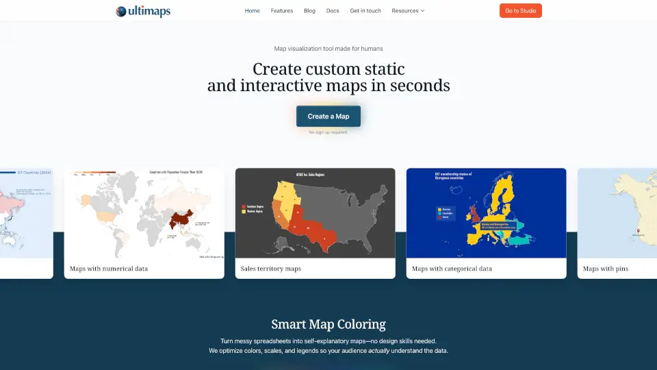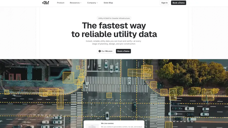
What is 4mAnalytics?
4M Analytics offers subsurface utility mapping solutions that provide a complete, accurate, and up-to-date database of subsurface infrastructure in the US. Their technology helps streamline utility risk mitigation and coordination right from the pre-design phase, all without leaving your desk.
What are the features of 4mAnalytics?
- Utility Location: Get precise details on buried utilities, including type, length, and count.
- Utility Owners: Identify the owners you’ll need to coordinate with for your project.
- Export to CAD: Download utility maps in formats like CAD, SHP, KMZ, DWG, DGN, DXF, and PDF.
- Utility Insights: Estimate project complexity with unique statistics and insights.
- Horizontal Imagery: Assess utility risk and plan field investigations effectively.
What are the use cases of 4mAnalytics?
- Civil Engineers: Access utility data and resolve conflicts early.
- General Contractors: Mitigate utility risks and streamline coordination.
- Utility Owners: Manage infrastructure with ease.
- Project Owners: Map utilities accurately for better planning.
How to use 4mAnalytics?
- Book a Demo: Start by scheduling a live demo to see the platform in action.
- Explore Data: Use the platform to locate utilities, identify owners, and export maps.
- Analyze Insights: Leverage the provided statistics to assess project complexity.
- Plan Fieldwork: Use horizontal imagery to minimize risks during field investigations.